Sarang Kang giving her presentation at the 2025 Winter Conference of KAGEE (The Korean Association of Geographic and Environmental Education), held at Ewha Womans University.
Sarang Kang in Master’s program gave a presentation titled “Development of a Place-Based Geographic and Environmental Education Program to Connect Students’ Lives with Their Local Environment” in the 2025 Winter Conference of KAGEE (The Korean Association of Geographic and Environmental Education, 한국지리환경교육학회) held at Ewha Womans University. She developed a geomorphic and environmental program to foster ecology-centered values (생태중심가치) for secondary school students, grounded in a placed-based education (장소기반교육) approach.
What most clearly distinguishes her program from many previous education programs is its emphasis on first strengthening students’ understanding of connectivity among environmental elements (i.e., geomorphology, hydrology, and biology), which is key to diagnosing the causes of local environmental problems and natural hazards. I truly appreciate her passion and dedication to helping students to have ecology-centered minds in their lives.
We are pleased to announce that our paper, “Effects of Relief on Headwater Catchment (최상류 유역) Landscapes“, submitted to Geomorphology was accepted for publication on August 9.
Conceptual landscape representation of a headwater catchment, showing its division into hillslopes, unchanneled valleys, colluvial channels, and fluvial channels.
The accepted paper constitutes the first chapter of the doctoral thesis of Dr. Hui Chen, who is currently a postdoctoral researcher at the Guangzhou Institute of Geography, Guangdong Academy of Sciences, China. I sincerely appreciate his continued efforts in updating his thesis work to address the requests of anonymous reviewers, which has led to substantial improvements in the final version. The abstract of the article is below:
Headwater catchments, comprising hillslopes, valley heads, and colluvial valleys, are critical sources of water, sediments, and nutrients for downstream river networks. As mass movements dominate these landscapes, topographic relief has long been recognized as a primary factor controlling geomorphic processes and the spatial arrangement of geomorphic units in headwater catchments. However, how the transition from hillslope- to channel-dominated processes varies with relief remains debated. Particularly, the ways in which valley head location—defined as the uppermost tip of an unchanneled valley—and the lower boundaries of headwater catchments—defined by the downstream limit of colluvial dominance—scale with relief are not fully understood. To address these questions, we analyzed a drainage basin in South Korea that spans a wide range of relief. We delineated valley heads and headwater catchment extents, and quantified the likelihoods of hillslope materials reaching both valley heads and downstream river network. Our results reveal that valley heads shift downslope with increasing relief and that the lower boundaries of colluvial channels extend downstream, enlarging headwater catchments. Likewise, both likelihoods of sediment connectivity increase with relief. These findings demonstrate that both valley head position and headwater catchment extent are governed by relief through its effects on hillslope material supply, colluvial valley morphology, and debris flow transport. Notably, the observed positive correlation between valley head source area and relief challenges the stream power-based channel initiation model, which exhibits a negative slope-area relationship. This study advances understanding of geomorphic processes in headwater landscapes and provides insights for managing mountainous environments.
We are pleased to announce that our paper, “Geomorphological Review of the Mountain Ridge Systems on the Korean Peninsula and Exploration of Methods for Establishing a More Scientific System (한반도 산줄기 체계에 대한 지형학적 검토와 과학적인 체계 정립 방안 모색)”, submitted to the Journal of the Association of Korean Geographers (한국지리학회지) was accepted last week.
Since last November, Jongmin and Juyeon have been carrying out together the first year of the ‘Forest Watershed Digital Mapping Project (산림수계수치지도 구축)’ commissioned by the Korea Forest Service’s (산림청) Landslide Prevention Division (산사태방지과), during which we have been revisiting the mountain ridges of the Korean Peninsula from a geomorphological perspective. Special thanks to Juyeon for his hard work, particularly in analyzing mountain ridges from extensive DEM data and developing the morphology-based classification system for mountain ridges. The article will appear in Vol. 14, No.2, scheduled for publication on June 30. The abstract of the article is below:
The traditional Sangyeongpyo (산경표) mountain ridge system, which has greatly influenced public perceptions of mountain terrain in Korea, has long been overlooked in Korean geomorphological research. As a result, the geomorphological significance of key elements of this system, particularly the Baekdudaegan (백두대간) and the hierarchical relationships between the Daegan (대간) and Jeongmaeg (정맥) ridges, remains unclear, and no scientific guidelines have yet been proposed regarding how the mountain ridge system of the Korean Peninsula should be further developed. To address these issues and to establish a more scientific and practically applicable mountain ridge system for the Korean Peninsula, this study (1) examined the hierarchical structures of major existing mountain ridge systems; (2) conducted comparative geomorphological analyses of the hierarchical characteristics of these systems; and (3) estimated the minimum threshold drainage area required to delineate the lowest-order mountain ridges that are morphologically distinguishable from higher-order ridges. The results suggest that a future mountain ridge system for Korea should inherit the hierarchical framework of the traditional Sangyeongpyo while integrating a divide-network approach and hierarchical classification of ridge segments, which more accurately represents ridge elevation and magnitude. Furthermore, our analyses indicate that, in order to derive geomorphologically meaningful ridge hierarchies, the minimum threshold drainage area for delineating mountain ridges should be at least 1km^2.
We are pleased to announce that our paper, “Classification of Colluvial Channels in a Mountain River: A Case Study of ‘Seoul National University Check Dam’ Catchment in Mt. Gwanak (산지 하천의 붕적하도 분류: 관악산 ‘서울대학교 사방댐’ 유역을 대상으로)”, subimitted to the Journal of the Korean Geomorphological Association (한국지형학회지) was accepted yesterday. Many thanks to Ha-eun for your hard work during your master’s thesis course, particularly for piloting the drone equipped with LiDAR sensor (link) and analyzing the collected LiDAR data. The article will appear in Vol. 32, No.2, scheduled for publication on June 30. The abstract of the article is below:
“The increasing frequency of extreme rainfall events due to climate change has heightened the risk of geomorphic hazards, such as debris flows and landslides, in mountainous areas. Colluvial channels, which typically occupy the uppermost sections of mountain river networks, serve as primary pathways for sediment transport during these events. Despite their geomorphic significance, few studies have classified colluvial channels, exhibiting diverse morphologies and processes over short distances, at the catchment scale. This study aims to classify colluvial channel subtypes in a granitic headwater catchment in Mt. Gwanak using a high-resolution(1 m) digital terrain model(DTM) generated from UAV-based LiDAR. For this purpose, 515 segments(10 m each) from colluvial channel network were extracted, and five geomorphic attributes were calculated from each segment: channel gradient, unit stream power, channel sinuosity, valley bottom width, and sediment connectivity. Hierarchical clustering based on the attributes revealed three subtypes: deposition-dominated, erosion-dominated, and highly coupled hillslope–channel reaches. ANOVA and PCA results indicated that channel gradient and valley bottom width were the most influential variables, with sediment connectivity also contributing to subtype differentiation. These findings highlight the morphological diversity of colluvial channels and offer a foundation for improving our understanding of sediment dynamics in mountainous areas.”
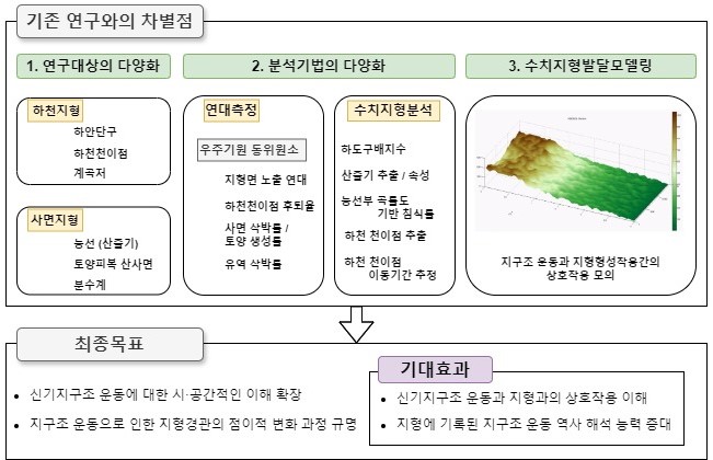
We are pleased to announce that our research proposal has been selected for the Mid-Career Researcher Program by National Research Foundation of Korea, with annual funding of approximately $14,660 (2,000만원) for a total three years). Through this program, we aim to deepen our understanding of the interaction between neo-tectonics and geomorphology along the eastern margin of Korean Peninsula. For more details, please refer to the following project outline:
Enhancing the Understanding of Neo-Tectonics in the Yeongdong Drainage Basins through Quantitative Analysis of Transient Landscape Features (점이적 지형 변화과정 분석을 통한 영동유역 신기 지구조 운동 이해의 확대)
The geological setting of the Korean Peninsula has traditionally been regarded as stable. However, several flights of coastal terraces are developed along the eastern margin of the peninsula. With the advancement of absolute dating methods, including optically stimulated luminescence (OSL) dating, it has been revealed that the eastern margin has experienced relatively rapid tectonic uplift, comparable to that of tectonically active areas, at least since approximately 150 Ka. Therefore, the Yeongdong drainage basin (영동유역) region, which is adjacent to the backbone mountain range (태백산맥) of the Korean Peninsula, has not been in a topographic steady state but has been undergoing a transient state in response to these neo-tectonic movements.
Despite these findings, few attempts have been made to understand how the Yeondong drainage basins have responded spatially to neo-tectonics or to extend the tectonic history beyond the upper dating limit of approximately 150 ka set by the OSL method. Consequently, the spatial distribution of neo-tectonic activities and the timing of the acceleration of tectonic uplift remain understudied.
Our research proposal aims to advance the understanding of neotectonics in both spatial and temporal dimensions. To address it, our research group will conduct quantitative terrain analyses for various transient landscape features in the Yeongdong area, extending beyond the coastal regions, and quantitatively measure surface process rates.
More specifically, in the first year, we’ll extract geomorphic surfaces from interfluves along watershed divide ridges, reconstruct paleo-river profiles in each study drainage basin based on the extracted surfaces, and ultimately reconstruct the tectonic uplift history of the Yeongdong areas by analyzing the steepness of paleo river longitudinal profiles.
In the second year, we’ll determine the rates of bedrock incision and knickpoint retreat through determination of the exposure ages of higher strath terraces, using terrestrial cosmogenic nuclides, developed along the main trunk with knickpoints in each drainage basin.
In the third year, we’ll assess transitional responses within a selected drainage basin by determining catchment wide denudation rates for tributary catchments with different elevation, hilltop denudation rates based on their curvatures, and soil production rates across soil mantled hillslopes.
Each year, we’ll complete our field and analytical work with application of landscape evolution modeling to validate the collected data.
On June 4, 2025, Jongmin gave a special lecture titled “Analysis of Geomorphological Landscapes using GIS and AI” for the students of the Korean Geomorphology School (한국지형학교) (Link to the post with lecture slides in the Naver Cafe of the School). I was very grateful for the opportunity to teach the students on this topic. While preparing the class, I also learned more about how AI models like ChatGPT could help us to analyze terrains, conduct landscape evolution modeling, and develop a module of current modeling systems.
아래는 한국지형학교 강의 당시 공유한 강의 관련 실습 자료(‘AI 경관 분석 2교시 강의 자료‘)에 대한 안내입니다. 필요하신 분은 참고하시기 바랍니다.
이번 강의에서는 간단한 실습이 준비되어 있습니다. 강의 동안에 간단한 실습을 따라하기 원하는 수강생분들은 다음 사이트에 회원 가입을 미리 해오시면 좋습니다. (유료 회원으로 가입하실 필요가 없고 무료 회원으로도 실습을 따라하는데 전혀 문제가 없습니다.)
Google Colab (https://colab.research.google.com/) : Google에서 제공하는 Python Jupyter Notebook 앱입니다.
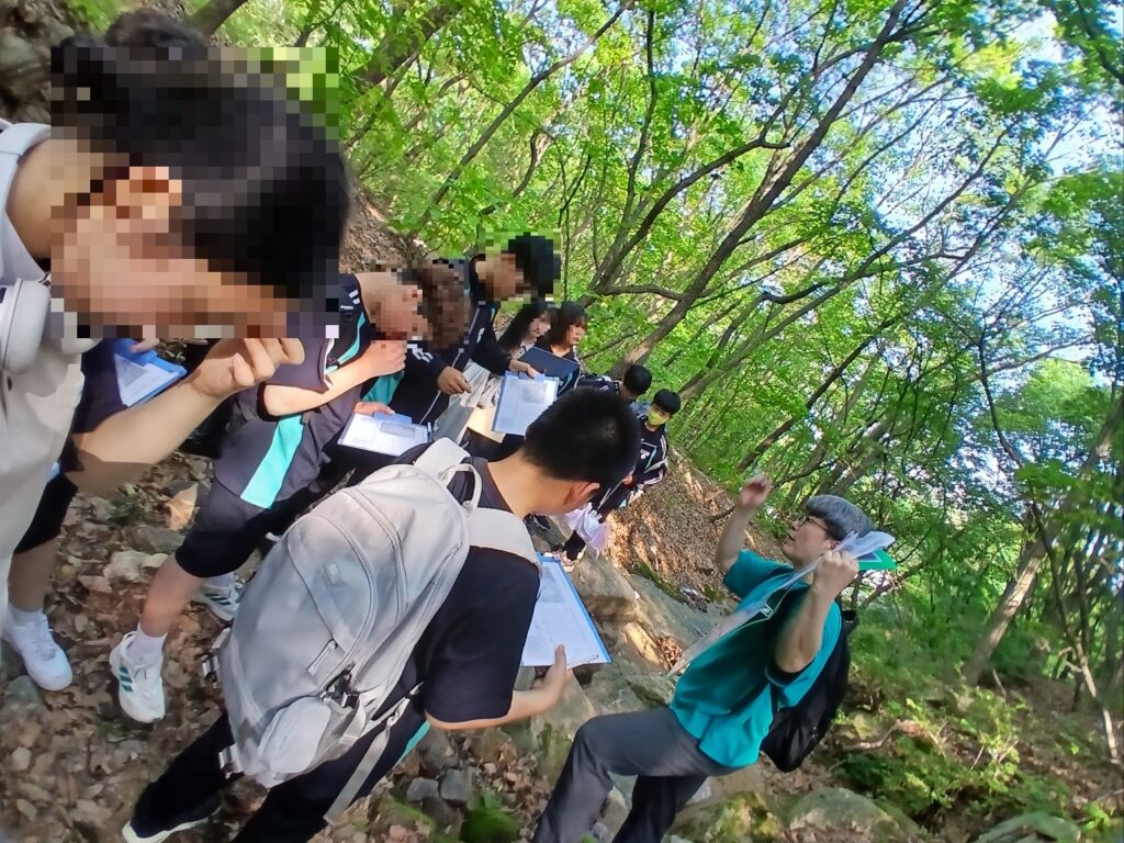
On May 26, 2025, doctoral student Seungwoo Ha led a geomorphology education field trip for middle school students as a part of dissertation work, which aims to develop a field trip program to enhance students’ awareness of geomorphological landscapes across their surrounding everyday space. Great job!
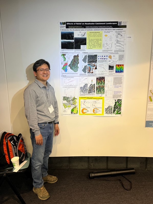
From May 12 to 15, 2025, Jongmin attended the “2025 CSDMS Annual Meeting: Exploring Earth’s Surface with Models, Data & AI” and presented a poster “Effects of Relief on Headwater Catchment Landscapes (Link)”. CSDMS stands for the Community Surface Dynamics Modeling System, an organization of researchers interested in earth surface processes and dynamics, particularly emphasizing the use, development, and interoperability of models. The conference featured many keynote talks related to these topics, as well as clinics for the practical use and introduction of various models.
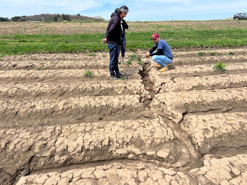
From April 29 to 30, 2025, Jongmin participated a field trip across the Driftless Area in Minnesota and Wisconsin, a region traditionally regarded as unglaciated but nonetheless influenced by past glacial processes. The field sites were organic farms, where soils have been studied by Azucena, Ph.D. student in Yoo Lab at UMN, to investigate soil characteristics and soil erosion vulnerability. The primary purpose of the field trip was to retrieve installed temperate sensors buried beneath soils on the organic farms. However, we discovered a deep, trench-like gully running across one of the fields.
On April 17, 2025, Jongmin attended the Workshop: Launching Sandpiper — How to Better Collaborate and Exchange Data Across Geomorphology (link) held at the St. Anthony Falls Laboratory in Minnesota. This workshop was designed to establish guidelines for effectively sharing geospatial data, particularly raster DEMs, among geomorphologists, including those focused on modeling, observation, and experimentation.
I often feel the need to identify metadata for the DEMs I use, such as creation date, georeferencing information, and sensor details. However, organizing these needs for collaborative research had not been my concern. This community, however, has taken a real step toward addressing this issue, and I found it very interesting.